
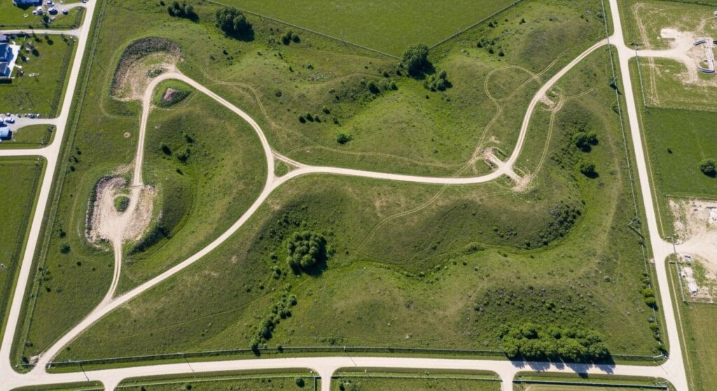
Aerial photography is a transformative asset in modern real estate, particularly for land and acreage where ground-level perspective is insufficient. By utilising professional drone technology, we provide buyers with a comprehensive bird’s-eye view that captures the true scale, topography, and unique features of a parcel. This strategic approach helps sellers present their property with total clarity, effectively filtering for serious, informed buyers and accelerating the closing process. At TrueVision Photography, we specialise in capturing land from the optimal vantage points to maximise your marketing impact. See our aerial photo work to understand our standard of quality.
Understanding Aerial Photography in Real Estate
Real estate aerial photography involves capturing images or videos of properties from elevated perspectives using drones (UAVs), helicopters, or even fixed-wing aircraft for large parcels. This method provides a complete perspective of the land, including terrain, surface objects, and the surrounding environment.
This perspective is invaluable for large plots, rural acreage, and complex terrain. It allows potential buyers to evaluate boundary lines, access points, and the surrounding environment, such as proximity to essential infrastructure or natural landmarks, before they even schedule a site visit. This transparency creates a more efficient sales process for both parties, which is exactly why aerial imagery sells faster in today’s fast-paced market.
Key Benefits of Aerial Photography for Land Sales
Better Visualisation of Property Size and Layout
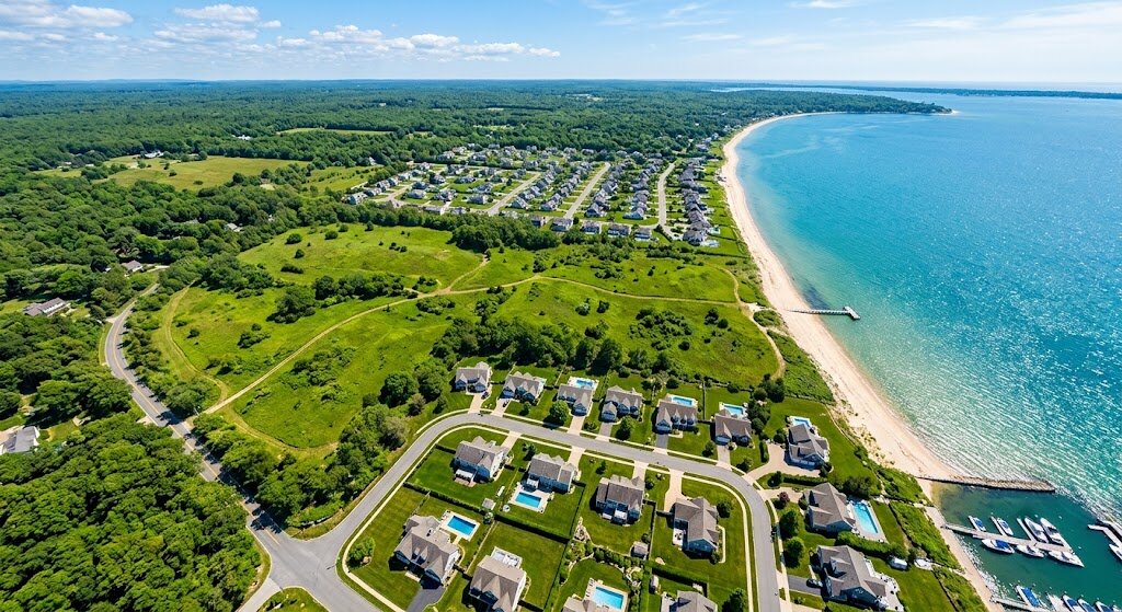
Ground-level photos often fail to convey the true scale of a property. Aerial photography provides the necessary context, showing property boundaries, slopes, and adjacent land. This allows buyers to visualise how the property fits within the local landscape, significantly improving their ability to make informed decisions.
Highlighting Unique Features
Aerial imagery brings attention to natural assets like water features, forest density, existing trails, or specific terrain formations that define the value of the land. For instance, if your parcel includes lake or ocean frontage, professional waterfront property aerial photography examples demonstrate how we capture the scenic value that drives premium pricing.
Creating Professional Marketing Materials
Professional aerial content elevates the quality of your entire marketing portfolio. Integrating high-resolution imagery into digital listings, printed brochures, and social media campaigns signals a professional and serious approach, which builds immediate trust with high-intent buyers.
Attracting More Serious Buyers
Properties marketed with professional aerial media naturally attract better-qualified leads. Evidence consistently shows that drones are drawing in more buyers and tenants, as the visual proof of a property’s condition reduces buyer anxiety.
Saving Time for Buyers and Sellers
By providing a “virtual tour” of the land’s layout, aerial photography eliminates many unnecessary site visits. This ensures that when a physical viewing does take place, it is with a prospect who is already genuinely interested in the property’s specific configuration.
Strategic Implementation of Aerial Imagery
To maximise the return on your investment, we recommend the following approach:
- Optimal Timing: We schedule shoots during the “golden hour” or under ideal lighting conditions to bring out textures and colours.
- Contextual Framing: We include surrounding amenities—such as proximity to major roads, shopping centres, or natural landmarks—to ground the property in its community.
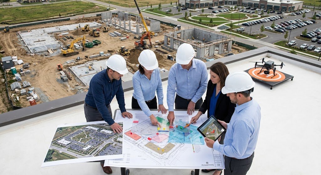
- Integrated Media: We combine high-resolution stills with drone videography to provide a dynamic, multi-dimensional experience. While we focus on land, our techniques are versatile; we also offer specialised drone footage for construction firms to document project progress.
- Boundary Emphasis: For specific listings, we can provide edited imagery that clearly highlights estimated boundary lines and access roads for immediate buyer clarity.
Property Marketing Value Table
| Feature | Strategic Benefit | Recommended Use |
| High-Res Photos | Precise property visualisation | MLS, Brochures, Print |
| Drone Videos | Immersive site walkthrough | Social Media, Virtual Tours |
| Topographic Views | Understanding land contours | Development & Investment sites |
| Seasonal Media | Demonstrating year-round potential | Long-term land marketing |
| Aerial Panoramas | Neighborhood & area context | Buyer orientation |
TrueVision Photography: Our Expert Edge
TrueVision Photography is built on the pillars of E-E-A-T (Experience, Expertise, Authoritativeness, and Trustworthiness). We provide professional-grade media services tailored to regional markets, including dedicated local photography services in Estero.
- Certified Professionalism: Our team operates under FAA Part 107 certification, ensuring that all flight operations are legal, safe, and fully compliant with national airspace regulations.
- Technical Precision: We utilise advanced drone hardware and high-resolution sensors to ensure that every image is sharp, colour-accurate, and ready for high-end marketing.
- Proven Track Record: Our aerial media has helped clients achieve significant results. For example, a 50-acre rural property in Texas saw a 40% increase in inquiries, while a Colorado listing reported a 25% increase in offers within two weeks of integrating our drone footage.
- Transparency: We believe in a clear, documented process, from the initial consultation to the final delivery- ensuring our clients know exactly what to expect at every stage.
Addressing Potential Considerations
We understand that you have questions regarding logistics. Here is how we proactively manage these factors:
- Regulatory Compliance: We handle all necessary airspace authorisations and FAA requirements so you don’t have to.
- Weather Sensitivity: Our team monitors local forecasts closely to ensure we shoot only when lighting and wind conditions are optimal for the highest image quality.
- Investment Value: While professional drone services represent an upfront cost, the increased speed of sale and potential for higher offers provide a strong return on investment for serious sellers.
Neighbourhood Perspective: Building Buyer Confidence
Understanding what lies beyond the property line is critical for land buyers. Aerial imagery clearly shows the property’s relationship to nearby schools, commercial centres, grocery stores, or medical facilities. Providing this “location context” builds buyer confidence, allowing them to see the convenience and potential of the site, which often increases the perceived value of the parcel.
Conclusion: Elevate Your Listing Today
Aerial photography is no longer an optional luxury; it is a proven tool for success in the competitive land and acreage market. By improving visualisation, highlighting unique features, and building trust through professional presentation, it ensures your listing stands out from the competition.
Whether you are selling a small plot or a vast estate, TrueVision Photography is ready to help you capture your property from the best possible angle. Call us today at 239-420-0789 to schedule your consultation and elevate your marketing strategy.
