
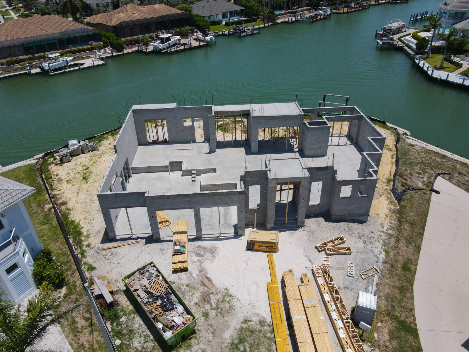
This Naples waterfront construction drone case study uses four real aerial images to document the visible shell, tile-roof installation, pool and courtyard, and front elevation of a new home. The street address, client, and builder remain private, and no timeline, visit count, deliverable, or project outcome is claimed without supplied evidence.
The image set demonstrates the proof layer behind TrueVision’s construction drone photography in Naples. For the planning method, read how often to document construction progress; for provider selection, use the construction drone photographer checklist; and for motion deliverables, compare our construction drone video guide. Then connect the proof to the contractor workflow and pricing factors.
What does the waterfront shell image establish?
The high oblique view records the building footprint, roof-stage condition, canal relationship, neighboring homes, rear exterior, and broad site access in one frame. It is useful as context because later close views can be interpreted against the whole property.
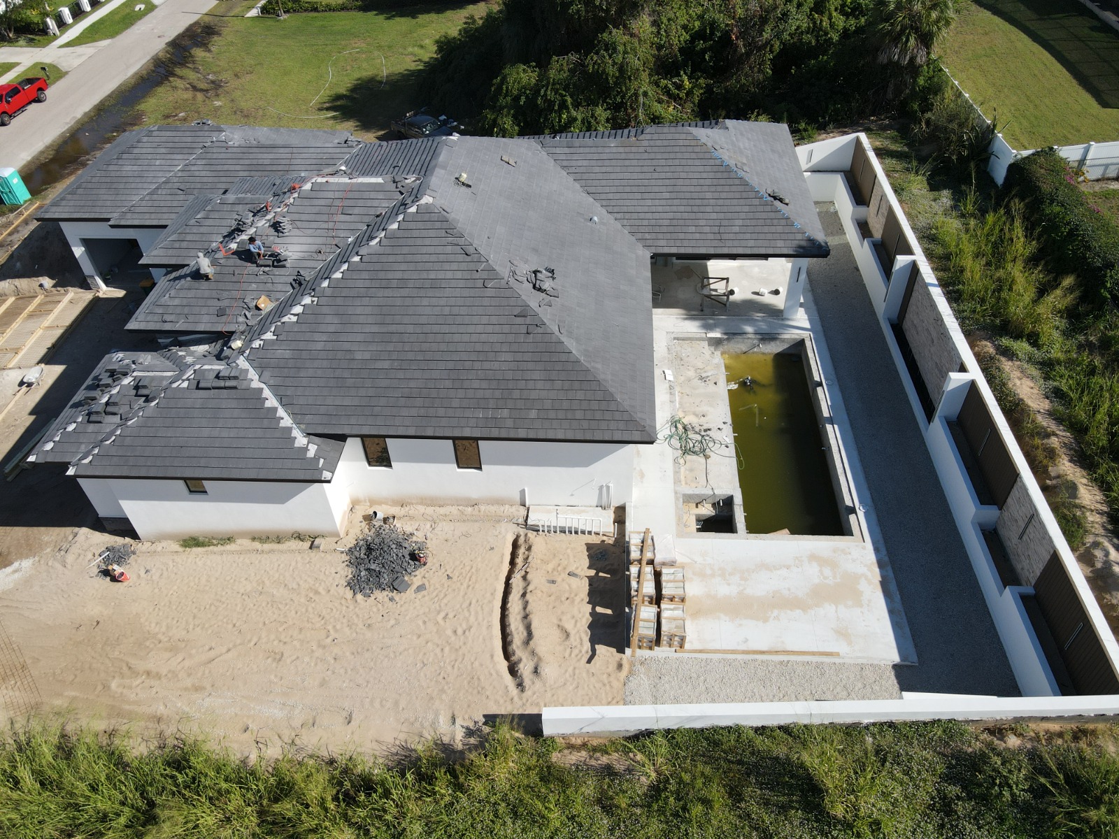
What does the roof-stage image preserve?
The roof image makes the visible installation stage readable while retaining the building’s footprint and immediate site context. A repeated view from a similar heading would allow a later stakeholder to compare installed areas without relying on memory or unrelated ground photos.
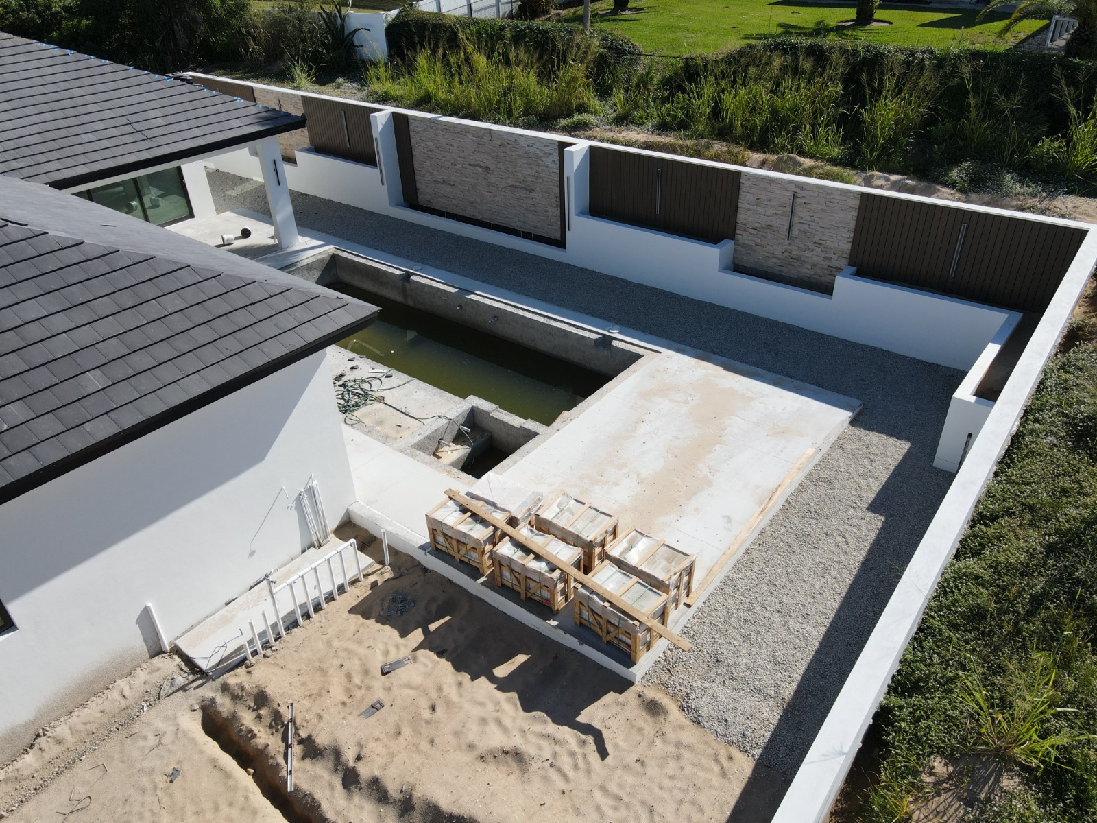
Why include the pool and courtyard view?
Waterfront residential construction often has several exterior work zones compressed onto one lot. An oblique courtyard image shows the relationship between the pool area, rear elevation, roof, canal edge, and neighboring boundaries more clearly than a tight detail alone.
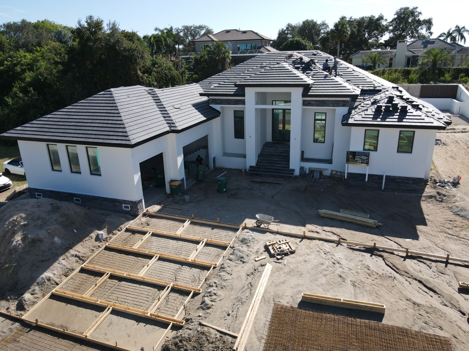
What does the front-elevation image add?
The front view adds the arrival side of the property, visible roofing activity, driveway and staging context, and the relationship between the home’s massing and the street-facing lot. Combined with the rear waterfront and courtyard views, it closes a major coverage gap.
What can—and cannot—be concluded from this case study?
| Supported by the supplied images | Not claimed without client evidence |
|---|---|
| Naples waterfront residential construction | Exact neighborhood or street address |
| Shell, roof, courtyard/pool, and front-elevation views | Number or timing of site visits |
| Real TrueVision construction media IDs 1864–1867 | Builder, owner, lender, or other client identity |
| A useful multi-angle property record | Schedule savings, dispute resolution, marketing result, or ROI |
This restraint is intentional: a useful case study shows what happened without inventing a testimonial or outcome. The same standard belongs in a written scope built from our practical contractor and builder guide and the variables in our construction drone cost guide.
What flight requirements apply to a Naples waterfront project?
Every site requires its own airspace and safety check. The FAA commercial-operator guidance governs work or business flights, while the FAA authorization process applies where controlled airspace is involved. The current Paradise Coast film-permitting page also distinguishes private-property filming with owner permission from circumstances that require a local permit.
TrueVision serves projects throughout the area, including properties reached through our North Naples photography coverage. Review the confirmed construction drone package prices or request a project-specific construction scope.
Frequently asked questions
Where is this Naples waterfront construction project?
The supplied media confirms Naples, Florida, and a waterfront residential build. The neighborhood and street address are not published because they were not supplied for public use and a case study must not expose a private property.
Are these real TrueVision construction photos?
Yes. The case study uses the four cleared construction-progress images stored as TrueVision media IDs 1864–1867: waterfront shell, tile-roof installation, pool and courtyard, and front elevation.
Does the case study identify the builder or client?
No. Naming a client, builder, or business requires permission. This page describes only the project type, confirmed city, and visible image content.
Can the same angles be repeated on future visits?
A repeatable construction plan can return to agreed headings, heights, and coverage where site and airspace conditions allow. That produces clearer comparisons than unrelated images from each visit.
Regulatory and permitting sources were checked on August 4, 2026. Confirm project-specific requirements before each flight.
Build an honest, repeatable aerial record of your Naples construction project. Call 239-420-0789, request construction drone photography, or review our photography packages and pricing.
